


Emilio García Ladona

Dr. Emilio García-Ladona
- 1995: staff researcher at the Institut de Ciències del Mar (ICM - CSIC) in Barcelona
- 2007 - 2009: Head of the former Department of Physical Oceanography, now Department of Physical and Technological Oceanography (DOFT)
- 2009 - 2012: Technical Deputy of the ICM.
- 06/2010 - : member of the Physical Oceanography Section within the Spanish Comission on Geophysics and Geodesy (CEGG) from the Spanish Ministry of Public Works and Transport
Major scientific interests are focused on: Mesoscale variability in the ocean: mixing processes and dynamics of the mixed layer, instabilities, topographic interactions and shelf/slope exchanges; dynamics of the western Mediterranean circulation; pattern recognition techniques applied to data analysis, specially in teledetection; operational oceanography.
Emilio García Ladona - (emilio@icm.csic.es)
 Dept. d'Oceanografia Fisica i Tecnològica
Institut de Ciències del Mar (ICM-CSIC)
Passeig Marítim, 37-49
08003 Barcelona (Spain)
Office: B-26
Tf: (+34) 93 230 9500 - 93 230 95 13
- MEDOSMOSIS (6119) new !
- COSMO (CTM2016-79474-R)
- MEDEAS (691287)
- ConnectinGEO (641538)
- FORMED (CGL2012-33989)
- MIDAS-7 (AYA2012-39356-C05-03)
- MEDESS-4MS (MED 2S-MED11-01)
- TOSCA (G-MED09-425)
- ICM Activities
Baleares experiment
- TOSCA web site
- ESEOO (VEM2003-20577-C14-10)
- Submarine Canyons (INTAS - 460)
- AFORO: Shape Analysis of Fish Otoliths (AVGION - TIC2000-0376-p4-04)
- Operational Oceanography Activities
National authorities carrying out maritime surveillance need constant updated and accurate information and effective operational infrastructures. There is a great deal of complexity to be dealt with marine spatial information obligations stemming from European Directives, initiatives and policies, in terms of maritime surveillance and safety. The MED OSMoSIS strategic project aims precisely to cut through this complexity by developing a few modules/applications about maritime surveillance activities and facilitating the exchange of information between different authorities.
The goal of COSMO is to improve our knowledge about the variability of the surface ocean currents near the Iberian Coasts and to improve the systems used by the Spanish Search and Rescue Agency and the National Police for the performance of their research and humanitarian duties institutionally assigned. COSMO aims to produce an Atlas of high-spatial resolution currents (daily average currents and variability) using the new set of reanalyses of the ocean circulation generated by European operational service. We will characterize both the circulation off the Iberian Peninsula and the statistical properties of the trajectories of drifting objects. A database of floating device trajectories (buoys, drifters and the like) will be created by compiling, document, homogenize, validate and inter-compare sets of observations and data scattered among different public entities and security bodies. The scientific research within COSMO will focus on the implementation and feasibility assessment of novel methodologies for deriving ocean currents from images of sea surface temperature, to fill the resolution gaps of current approaches to estimate ocean currents from drifter trajectories and sea level. These products lack of the appropriate spatial and temporal resolution required to capture the horizontal gradients at the scales of 1-10 km, deemed to be important for search and rescue activities (SAR) and for air-sea interactions. We will also investigate the impact of the assimilation of these novel observations in a regional model of the Strait of Gibraltar. The COSMO project will undertake a high-resolution Lagrangian experiment to gather information about the interactions between sub-mesoscale, mesoscale and large-scale flows in one of the regions with the largest density of marine traffic. The data gathered will help to assess the operational system. COSMO is a non-coordinated project direclty involving a research body (CSIC) and three public bodies with the largest social responsibilities regarding marine monitoring, prediction and security (Puertos del Estado, SASEMAR and Policía Nacional).
![]() MEDEAS project will design a new energy-economy model for the EU transition to a low carbon emissions energy system. The model will take into account the necessary flexibility and granularity to deal with different levels of complexity according to stakeholders interests and will be built as an open source initiative to boost a cooperative development.
MEDEAS project will design a new energy-economy model for the EU transition to a low carbon emissions energy system. The model will take into account the necessary flexibility and granularity to deal with different levels of complexity according to stakeholders interests and will be built as an open source initiative to boost a cooperative development.
![]() ConnectinGEO’s primary goal is to link existing coordinated Earth observation networks with science and technology (S&T) communities, the industry sector and the GEOSS and Copernicus stakeholders. The aim is to facilitate a broader and more accessible knowledge base to support the needs of the GEO Societal Benefit Areas (SBAs) and their users. A broad range of subjects from climate, natural resources and raw materials, to the emerging UN Sustainable Development Goals (SDGs) will be addressed.
ConnectinGEO’s primary goal is to link existing coordinated Earth observation networks with science and technology (S&T) communities, the industry sector and the GEOSS and Copernicus stakeholders. The aim is to facilitate a broader and more accessible knowledge base to support the needs of the GEO Societal Benefit Areas (SBAs) and their users. A broad range of subjects from climate, natural resources and raw materials, to the emerging UN Sustainable Development Goals (SDGs) will be addressed.
 The proposed research project deals about the characterization of the large-scale bed forms (> 1 m) of the Spanish Mediterranean continental margin based on the analysis of their morphology and the study of contemporary processes involved in their formation and evolution. The multibeam bathymetry provided by the Secretaría de Pesca and other institutions allows a regional classification of bed forms based on their morphometric characteristics.
In parallel, a specific monitoring of hydrodynamics and sediment transport processes in the near-bottom boundary layer and the water column will be carried out to study: 1) wave-current processes potentially associated with dunes in the coastal area (Ebro Delta), 2) internal waves associated with sediment waves of prodelta (the Llobregat prodelta), 3) internal waves as potential generating mechanism of sediment waves on the continental slope (Gulf of Valencia) and 4) to investigate deep bottom currents as potential mechanism to explain the deep sediment waves (North of Menorca). The analysis of the interaction between bed forms and hydrodynamic forcing will be complemented by the application of models of sediment transport and bed form generation as well as flume tests.
Finally, bed forms will be analyzed as specific habitats in the Ebro delta and Cabo de Palos areas, characterized by their communities and benthic habitats. Habitat mapping techniques will be developed integrating physical, geological and biological information, in order to provide a useful tool in managing the marine environment. It is expected that results from the project will provide a regional overview of the bed forms of the Spanish Mediterranean continental margin as well as detailed information of those bed forms with greater uncertainty about the formation processes. The expected results may lead to a change in our perception of what are the dominant mechanisms of formation and evolution of bed forms and their rates of change. The combined use of the excellent available morphological database and field measurements using advanced instrumentation (benthic tripod, thermistor chains, multiparameter equipment, AUV, ROV\'s, etc) offers the opportunity to integrate information from different sources for a better understanding of the processes involved in bed forms formation.
The preparation of an Atlas of bed forms in the Spanish Mediterranean continental margin based on the observed morphologies will provide to both the scientific community and society in general, access to the present-day existing knowledge on this topic.
 The SMOS satellite, launched in November 2009, is the first ESA Earth observation (EO) mission coled by Spain. With an unprecedented EO scientific, technological, and industrial leading role, Spain’s goal has been to produce, for the first time, global sea surface salinity and soil moisture maps by means of the novel synthetic aperture interferometric radiometer (MIRAS). Thanks to the Spanish National R\&D program and ESA funding, and with the support from CDTI, the proposing team has successfully addressed various scientific and technological challenges, such as: i) establish an operational data production and dissemination centre in Spain, the CP34; ii) to bring together scientific and technological know-how within the CP34 associated expert centre, the SMOS BEC; and iii) to consolidate new teams and facilities dedicated to the development of SMOS products. After two years of intense work, the SMOS nominal products will be soon consolidated. As such, this proposal also focuses, for the first time, on the development of novel SMOS-based added-value products and new applications of interest for the industry and public managers. Moreover, to capitalize the know-how of the team, this proposal addresses new challenges as the SMOS synergy with new EO missions or the development of new products beyond SMOS. However, to maintain the international role of Spain in this leading-edge scientific area is necessary to consolidate this specialized and talented team together with its synergy with the industry.
![]() MEDESS-4MS service is dedicated to the maritime risks prevention and strengthening of maritime safety related to oil spill pollution in the Mediterranean. The main goal of MEDESS-4MS is to deliver an integrated operational multi model oil spill prediction service in the Mediterranean, connected to existing oil spill monitoring platforms (EMSA-CSN, REMPEC and AIS data), using well established oil spill modeling systems, the environmental data from the GMES European Marine Service and the MS national ocean forecasting systems. MEDESS-4MS does not aim at developing new elementary service chains but will integrate and consolidate the existing ones, based on the experience gained through the interaction with operational response agencies, REMPEC and EMSA during real oil spill incidents in the region and the demonstrations and inter-calibration exercises carried out in the framework of EC projects.
MEDESS-4MS service is dedicated to the maritime risks prevention and strengthening of maritime safety related to oil spill pollution in the Mediterranean. The main goal of MEDESS-4MS is to deliver an integrated operational multi model oil spill prediction service in the Mediterranean, connected to existing oil spill monitoring platforms (EMSA-CSN, REMPEC and AIS data), using well established oil spill modeling systems, the environmental data from the GMES European Marine Service and the MS national ocean forecasting systems. MEDESS-4MS does not aim at developing new elementary service chains but will integrate and consolidate the existing ones, based on the experience gained through the interaction with operational response agencies, REMPEC and EMSA during real oil spill incidents in the region and the demonstrations and inter-calibration exercises carried out in the framework of EC projects.
MEDGIB experiment
![]() The TOSCA (Tracking Oil Spills and coastal Awareness) project aims to develop a long-lasting network of policy makers & scientists for observation & forecasting of marine accidents (oil pollution, Search And Rescue (SAR) operations...), in the Mediterranean Sea. TOSCA will supply forecast models, risk maps & action plans developed by the scientists in collaboration with the local authorities, which will enable them to improve their immediate response capacity & to ensure a sustainable costal monitoring.
The TOSCA (Tracking Oil Spills and coastal Awareness) project aims to develop a long-lasting network of policy makers & scientists for observation & forecasting of marine accidents (oil pollution, Search And Rescue (SAR) operations...), in the Mediterranean Sea. TOSCA will supply forecast models, risk maps & action plans developed by the scientists in collaboration with the local authorities, which will enable them to improve their immediate response capacity & to ensure a sustainable costal monitoring.
García-Olivares A., J.L. de Pablos, R. Madrigal
Sailing the Prestige out to sea. An independent analysis.
Scientia Marina, 75, 3, 533-548.
![]() ESEOO has been a project to promote the Operational Oceanography at a national level. More precisely, to give scientific assessment and expertise to improve the management of marine emergencies. The project has been composed by 24 research groups from several national and international laboratories and universities and with the participation of the spanish Marine Search and Rescue Agency (SASEMAR). Web - DOF
ESEOO has been a project to promote the Operational Oceanography at a national level. More precisely, to give scientific assessment and expertise to improve the management of marine emergencies. The project has been composed by 24 research groups from several national and international laboratories and universities and with the participation of the spanish Marine Search and Rescue Agency (SASEMAR). Web - DOF
Machín F., M. Emelianov, P. Rodríguez, E. García-Ladona, J. Menéndez, J. Salat
XBT profilers for operational purposes: application and validation in real exercises.
Scientia Marina, 72, 4, 779-799. DOI: 10.3989/scimar.2008.72n4779
Sotillo M.G., E. Álvarez Fanjul, S. Castanedo, A.J. Abascal, J. Menendez, M. Emelianov, R. Olivella, E. García-Ladona, M. Ruiz-Villarreal, J. Conde, M. Gómez, P. Conde, A.D. Gutierrez, R. Medina
Towards an operational system for oil-spill forecast over Spanish waters: Initial developments and implementation test.
Marine Pollution Bulletin, 56, 4, 686-703. DOI: 10.1016/j.marpolbul.2007.12.021
 This was a joint spanish-russian cooperation project to provide a deeper understanding of physical mechanisms that control the hydrodynamic regimes associated with submarine canyons and to evaluate their impact on mass transfer between the continental shelf and open ocean. (Web).
Palanques A., E. García-Ladona, D. Gomis, J. Martín, M. Marcos, A. Pascual, P. Puig, J.M. Gili, M. Emelianov, S. Montserrat, J. Guillén, J. Tintoré, M. Segura, A. Jordi, S. Ruiz, G. Basterretxea, J. Font, D. Blasco, F. Pagès
General patterns of circulation, sediment fluxes and ecology of the Palamós (La Fonera) submarine canyon, northwestern Mediterranean.
Progress in Oceanography, 66, 89-119. DOI: 10.1016/j.pocean.2004.07.016
Puig P., A. Palanques, J. Guillén, E. García-Ladona
Deep slope currents and suspended particle fluxes in and around the Foix submarine canyon (NW Mediterranean)..
Deep-Sea Research. Part I: Oceanographic Research Papers, 47, 343-366. DOI: 10.1016/S0967-0637(99)00062-X

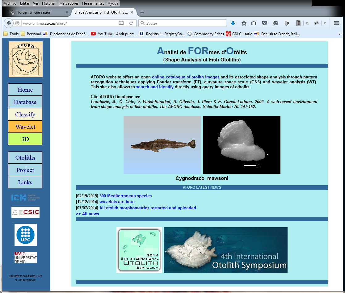
Parisi-Baradad V., A. Manjabacas, A. Lombarte, R. Olivella, Ò. Chic, J. Piera, E. García-Ladona
Automated Taxon Identification of Teleost fishes using an otolith online database—AFORO.
Fisheries Research, 105, 1, 13-20. DOI: 10.1016/j.fishres.2010.02.005
Lombarte A., O. Chic, V. Parisi-Baradad, R. Olivella, J. Piera, E. García-Ladona
A web-based environment for shape analysis of fish otoliths. The AFORO database.
Scientia Marina, 70, 1, 147-152.
Parisi-Baradad V., A. Lombarte, E. García-Ladona, J. Cabestany, J. Piera, O. Chic
Otolith shape contour analysis using affine transformation invariant wavelet transforms and curvature scale space representation.
Marine and Freshwater Research, 56, 795-804. DOI: 10.1071/MF04162
Piera J., V. Parisi-Baradad, E. García-Ladona, A. Lombarte, L. Recasens, J. Cabestany
Otolith shape feature extraction oriented to automatic classification with open distributed data.
Marine and Freshwater Research, 56, 805-814. DOI: 10.1071/MF04163
VADO development: A system for accessing and visualizing data through Google maps viewer. Now we are moving towards a Marine Spatial Data Infrastructure (IDE)
BUDAS system: A system to automatically collect and distribute drifting buoys localisation from satellite (ARGOS, IRIDIUM, etc,), and to build animation through Google EARTH and Google maps.
- Martínez J., F.E. Leonelli, E. García-Ladona, J. Garrabou, D.K. Kersting, N. Bensoussan, A. Pisano
Evolution of marine heatwaves in warming seas: the Mediterranean Sea case study. Frontiers in Marine Science, 10, DOI: 10.3389/fmars.2023.1193164 (2023) - Martínez J., E. García-Ladona, J. Ballabrera-Poy, J. Isern-Fontanet, S. González-Motos, J.M. Allegue, C. González-Haro
Atlas of surface currents in the Mediterranean and Canary–Iberian–Biscay waters.. Journal of Operational Oceanography, DOI: 10.1080/1755876X.2022.2102357 (2022) - Isern-Fontanet J., E. García-Ladona, C. González-Haro, A. Turiel, M. Rosell-Fieschi, J.B. Company, A. Padial
High-Resolution Ocean Currents from Sea Surface Temperature Observations: The Catalan Sea (Western Mediterranean). Remote Sensing, 13, 3635, DOI: 10.3390/rs13183635 (2021) - Isern-Fontanet J., E. García-Ladona, J.A. Jiménez-Madrid, E. Olmedo, M. García-Sotillo, A. Orfila, A. Turiel
Real-time Reconstruction of Surface Velocities from Satellite Observations in the Alboran Sea. Remote Sensing, 12, 724-741. DOI: 10.3390/rs12040724 (2020) - Solé J., R. Samsó, E. García-Ladona, A. García-Olivares , J. Ballabrera-Poy, T. Madurell, A. Turiel, O. Osychenko, D. Álvarez, U. Bardi, M. Baumann, K. Buchmann, I. Capellán-Pérez, M. Cerný, O. Carpintero, I. De Blas, C. De Castro, J.-D. De Lathouwer, C. Duce, L. Eggler, J.M. Enríquez, S. Falsini, K. Feng, N. Ferreras, F. Frechoso, K. Hubacek, A. Jones, R. Kaclíkova, C. Kerschner, C. Kimmich, L.F. Lobejon, P. L. Lomas , G. Martelloni, M. Mediavilla, L.J. Miguel, D. Natalini, J. Nieto, A. Nikolaev, G. Parrado, S. Papagianni, I. Perissi, C. Ploiner, L. Radulov, P. Rodrigo, L. Sun, M. Theofilidi
Modelling the renewable transition: Scenarios and pathways for a decarbonized future using pymedeas, a new open-source energy systems model. Renewable and Sustainable Energy Reviews, 132, 110105. DOI: 10.1016/j.rser.2020.110105 (2020) - Isern-Fontanet J., J. Ballabrera-Poy, A. Turiel, E. García-Ladona
Remote sensing of ocean surface currents: a review of what is being observed and what is being assimilated. Nonlinear Processes in Geophysics, 24, 613-643. DOI: 10.5194/npg-24-613-2017 (2017) - García-Ladona E., J. Salvador, P. Fernández, J.L. Pelegrí, P. Elósegui, O. Sánchez, J.A. Jiménez, F. Pérez, J. Ballabrera, J. Isern-Fontanet, J. Salat, J. Font
Thirty years of research and development of Lagrangian buoys at the Institute of Marine Sciences. Scientia Marina, 80S1, 141-158. DOI: 10.3989/scimar.04325.14A (2016) - Isern-Fontanet J., E. Olmedo, A. Turiel, E. García-Ladona
Retreival of eddy dynamics from SMOS Sea Surface Salinity measurements in the Algerian Basin (Mediterranean Sea). Geophysical Research Letters, DOI: 10.1002/2016GL069595 (2016) - Solé J., E. García-Ladona, J. Piera, M. Estrada
Parameter constraints of grazing response functions. Implications for phytoplankton bloom initiation. Scientia Marina, 80S1, 129-137. DOI: 10.3989/scimar.04271.18A (2016) - Solé J., M. Emelianov, A. Ostrovskii, P. Puig, E. García-Ladona
Fine-scale water mass variability inside a narrow submarine canyon (the Besòs Canyon) in the NW Mediterranean Sea. Scientia Marina, 80S1, 195-204. DOI: http://dx.doi.org/10.3989/scimar.04322.05A (2016) - García Sotillo M., E. Garcia-Ladona, A. Orfila, P. Rodríguez-Rubio, J. Cristobal Maraver, D. Conti, E. Padorno, J.A. Jiménez, E. Capó, F. Pérez, J.M. Sayol, F.J. de los Santos, A. Amo, A. Rietz, C. Troupin, J. Tintore, E. Álvarez-Fanjul
The MEDESS-GIB database: tracking the Atlantic water inflow. Earth System Science Data, 8, 1, 141-149. DOI: 10.5194/essd-8-141-2016 (2016) - Malanotte-Rizzoli P., V. Artale, G. L. Borzelli-Eusebi, S. Brenner , A. Crise, M. Gacic, N. Kress, S. Marullo, M. Ribera d’Alcalà, S. Sofianos, T. Tanhua, A. Theocharis, M. Alvarez, Y. Ashkenazy, A. Bergamasco, V. Cardin, S. Carniel, G. Civitarese, F. D’Ortenzio, J. Font, E. García-Ladona, J. M. Garcia-Lafuente, A. Gogou, M. Gregoire, D. Hainbucher, H. Kontoyannis, V. Kovacevic, E. Kraskapoulou, G. Kroskos, A. Incarbona, M. G. Mazzocchi, M. Orlic, E. Ozsoy, A. Pascual, P.-M. Poulain, W. Roether, A. Rubino, K. Schroeder, J. Siokou-Frangou, E. Souvermezoglou, M. Sprovieri, J. Tintoré, G. Triantafyllou
Physical forcing and physical/biochemical variability of the Mediterranean Sea: a review of unresolved issues and directions for future research. Ocean Science, 10, 281-322. DOI: 10.5194/os-10-281-2014 (2014) - Solé J., A. Turiel, A. García-Olivares, J. Ballabrera-Poy, E. García-Ladona
Energia i societat: la Taxa de Retorn Energètic. Revista de Física, 4, 10, 13-20. (2013) - García-Olivares A., J. Ballabrera-Poy, E. García-Ladona, A. Turiel
A global renewable mix with proven technologies and common materials. Energy Policy, 41, 561-574. (2012) - Solé J., A. García-Olivares, E. García-Ladona, J. Ballabrera, A.Turiel
Energia i Societat. Revista de Física, 4, 9, 24-27. (2012) - Chic Ò., R. Olivella, E. García-Ladona
SAIDIN: A Tool to Access, Visualize and Distribute Satellite Data. Sea Technology, 51, 4, 56-58. (2010) - Mancho A.M., S. Wiggins, A. Turiel, E. Hernández-García, C. López, E. García-Ladona
Preface. Nonlinear Processes in Geophysics, 17, 283-285. DOI: 10.5194/npg-17-283-2010 (2010) - Parisi-Baradad V., A. Manjabacas, A. Lombarte, R. Olivella, Ò. Chic, J. Piera, E. García-Ladona
Automated Taxon Identification of Teleost fishes using an otolith online database—AFORO. Fisheries Research, 105, 1, 13-20. DOI: 10.1016/j.fishres.2010.02.005 (2010) - Ballabrera-Poy J., B. Mourre, E. García-Ladona, A. Turiel, J. Font
Linear and non-linear T-S models for the eastern North Atlantic from Argo data : Role of surface salinity observations. Deep-Sea Research. Part I: Oceanographic Research Papers, 56, 10, 1605-1614. DOI: 10.1016/j.dsr.2009.05.017 (2009) - d’Ovidio F., J. Isern-Fontanet , C. López, E. Hernández-García , E. García-Ladona
Comparison between Eulerian diagnostics and finite-size Lyapunov exponents computed from altimetry in the Algerian basin. Deep-Sea Research. Part I: Oceanographic Research Papers, 56, 1, 15-31. DOI: 10.1016/j.dsr.2008.07.014 (2009) - Turiel A., V. Nieves, E. García-Ladona, J. Font, M.H. Rio, G. Larnicol
The multifractal structure of satellite sea surface temperature maps can be used to obtain global maps of streamlines. Ocean Science, 5, 4, 447-460. DOI: 10.5194/os-5-447-2009 (2009) - Machín F., M. Emelianov, P. Rodríguez, E. García-Ladona, J. Menéndez, J. Salat
XBT profilers for operational purposes: application and validation in real exercises. Scientia Marina, 72, 4, 779-799. DOI: 10.3989/scimar.2008.72n4779 (2008) - Mourre B., J. Ballabrera-Poy, E. García-Ladona, J. Font
Surface salinity response to changes in the model parameters and forcings in a climatological simulation of the eastern North-Atlantic Ocean. Ocean Modelling, 23, 21-32. DOI: 10.1016/j.ocemod.2008.03.002 (2008) - Sotillo M.G., E. Álvarez Fanjul, S. Castanedo, A.J. Abascal, J. Menendez, M. Emelianov, R. Olivella, E. García-Ladona, M. Ruiz-Villarreal, J. Conde, M. Gómez, P. Conde, A.D. Gutierrez, R. Medina
Towards an operational system for oil-spill forecast over Spanish waters: Initial developments and implementation test. Marine Pollution Bulletin, 56, 4, 686-703. DOI: 10.1016/j.marpolbul.2007.12.021 (2008) - Turiel A., J. Solé, V. Nieves, J. Ballabrera-Poy, E. García-Ladona
Tracking oceanic currents by singularity analysis of Microwave Sea Surface Temperature images. Remote Sensing of Environment, 112, 2246-2260. DOI: 10.1016/j.rse.2007.10.007 (2008) - García-Olivares A., J. Isern-Fontanet, E. García-Ladona
Dispersion of passive tracers and finite-scale Lyapunov exponents in the Western Mediterranean Sea. Deep-Sea Research. Part I: Oceanographic Research Papers, 54, 253-268. DOI: 10.1016/j.dsr.2006.10.009 (2007) - Isern-Fontanet J., A. Turiel, E. García-Ladona, J. Font
Microcanonical multifractal formalism: Application to the estimation of ocean surface velocities. Journal of Geophysical Research, 112, C05024. DOI: 10.1029/2006JC003878 (2007) - Nieves V., C. Llebot, A. Turiel, J. Solé, E. García-Ladona, D. Blasco, M. Estrada
Common turbulent signature in sea surface temperature and chlorophyll maps. Geophysical Research Letters, 34, L23602,. DOI: 10.1029/2007GL030823 (2007) - Turiel A., J. Isern-Fontanet, E. García-Ladona
Wavelet filtering to extract coherent vortices from altimetric data. Journal of Atmospheric and Oceanic Technology, 24, 12, 2103-2119. DOI: 10.1175/2007JTECHO434.1 (2007) - Turiel A., J. Isern-Fontanet, E. García-Ladona, J.A. Young
Detection of wave fronts in the Indian Ocean from geostationary sunglint satellite imagery. International Journal of Remote Sensing, 28, 17, 3953-3962. DOI: 10.1080/01431160601047789 (2007) - Chic O., R. Olivella, E. García-Ladona, J. Font
SAIDIN (SAtellite Image Database INterface) un sistema de distribución de datos satélite vía web. Revista de Teledetección, SP, 25, 105-108. (2006) - Isern-Fontanet J., E. García-Ladona, J. Font, A. García-Olivares
Non-Gaussian velocity probability density functions: An altimetric perspective of the Mediterranean Sea. Journal of Physical Oceanography, 36, 11, 2153-2164. (2006) - Isern-Fontanet J., E. García-Ladona, J. Font
Vortices of the Mediterranean Sea: an altimetric perspective. Journal of Physical Oceanography, 36, 1, 87-103. (2006) - Lombarte A., O. Chic, V. Parisi-Baradad, R. Olivella, J. Piera, E. García-Ladona
A web-based environment for shape analysis of fish otoliths. The AFORO database. Scientia Marina, 70, 1, 147-152. (2006) - Solé J., M. Estrada, E. García-Ladona
Biological control of harmful algal blooms: A modelling study. Journal of Marine Systems, 61, 165-179. DOI: 10.1016/j.jmarsys.2005.06.004 (2006) - Solé J., E. García-Ladona, M. Estrada
The role of selective predation in harmful algal blooms. Journal of Marine Systems, 62, 46-54. DOI: 10.1016/jmarsys.2006.04.002 (2006) - Turiel A., V. Nieves, E. García-Ladona
Técnicas multifractales para la extracción de la función de corriente a partir de imágenes de la superficie del mar. Revista de Teledetección, SP, 25, 134-138. (2006) - Palanques A., E. García-Ladona, D. Gomis, J. Martín, M. Marcos, A. Pascual, P. Puig, J.M. Gili, M. Emelianov, S. Montserrat, J. Guillén, J. Tintoré, M. Segura, A. Jordi, S. Ruiz, G. Basterretxea, J. Font, D. Blasco, F. Pagès
General patterns of circulation, sediment fluxes and ecology of the Palamós (La Fonera) submarine canyon, northwestern Mediterranean. Progress in Oceanography, 66, 89-119. DOI: 10.1016/j.pocean.2004.07.016 (2005) - Parisi-Baradad V., A. Lombarte, E. García-Ladona, J. Cabestany, J. Piera, O. Chic
Otolith shape contour analysis using affine transformation invariant wavelet transforms and curvature scale space representation. Marine and Freshwater Research, 56, 795-804. DOI: 10.1071/MF04162 (2005) - Piera J., V. Parisi-Baradad, E. García-Ladona, A. Lombarte, L. Recasens, J. Cabestany
Otolith shape feature extraction oriented to automatic classification with open distributed data. Marine and Freshwater Research, 56, 805-814. DOI: 10.1071/MF04163 (2005) - Solé J., E. García-Ladona, P. Ruardij, M. Estrada
Modelling allelopathy among marine algae. Ecological Modelling, 183, 373-384. DOI: 10.1016/j.ecolmodel.2004.08.021 (2005) - Turiel A., J. Isern-Fontanet, E. Garcia-Ladona, J. Font
Multifractal metod for the instantaneous evaluation of the stream function in geophysical flows. Physical Review Letters, 95, 10, 104502. DOI: 10.1103/PhysRevLett.95.104502 (2005) - Isern-Fontanet J., J. Font, E. García-Ladona, M. Emelianov, C. Millot, I. Taupier-Letage
Spatial structure of anticyclonic eddies in the Algerian basin (Mediterranean Sea) analyzed using the Okubo-Weiss parameter. Deep-Sea Research Part II: Topical Studies in Oceanography, 51, 24-25, 3009-3028. DOI: 10.1016/j.dsr2.2004.09.013 (2004) - Pelegrí J.L., M. Auladell, A.W. Ratsimandresy, P. Sangrà, E. García-Ladona
Inertial instability in oceanic flows. ERCOFTAC Bulletin, 60, 22-29. (2004) - Isern-Fontanet J., E. García-Ladona, J. Font
Identification of marine eddies from altimetric maps. Journal of Atmospheric and Oceanic Technology, 20, 772-778. (2003) - Salas J., C. Millot, J. Font, E. García-Ladona
Analysis of mesoscale phenomena in the Algerian basin observed with drifting buoys and infrared images. Deep-Sea Research. Part I: Oceanographic Research Papers, 49, 2, 245-266. DOI: 10.1016/S0967-0637(01)00052-8 (2002) - Ruíz J., F. Echevarría, J. Font, S. Ruiz, E. García-Ladona, J. M. Blanco, F. Jiménez-Gómez, L. Prieto, A. González-Alaminos, C.M. García, P. Cipollini, H. Snaith, A. Bartual, A. Reul, V. Rodríguez
Surface distribution of chlorophyill, particles and gelbstoff in the Atlantic jet of the Alborán Sea: from submesoscale to subinertial scales of variability.. Journal of Marine Systems, 29, 4, 277-292. (2001) - Salas J., E. García-Ladona, J. Font
Statiscal analysis of the surface circulation in the Algerian Current using Lagrangian buoys. Journal of Marine Systems, 29, 69-85.. (2001) - Puig P., A. Palanques, J. Guillén, E. García-Ladona
Deep slope currents and suspended particle fluxes in and around the Foix submarine canyon (NW Mediterranean).. Deep-Sea Research. Part I: Oceanographic Research Papers, 47, 343-366. DOI: 10.1016/S0967-0637(99)00062-X (2000) - Salas The ELISA group (J., E. García-Ladona, J. Font, C. Millot)
ELISA: Eddies and Leddies Interdisciplinary Study in the Algerian basin..
MTP news, 6, 9-10. (1998) - García-Ladona E.,
Book Review of Mixing in Geophysical Flows, J.M. Redondo, O. Metais (eds.) International Center for Numerical Methods. Barcelona, 1995.. Scientia Marina, 60, 2-3, 433-434. (1996) - García-Ladona E., A. Castellón, J. Font, J. Tintoré
The balearic current and volume transports in the Balearic basin. Oceanologica Acta, 19, 5, 489-497. (1996) - Font J., E. García-Ladona, E. García Górriz
The seasonality of mesoscale motion in the Northern Current of the western Mediterranean: several years of evidence. Oceanologica Acta, 18, 2, 207-219. (1995) - EUROMODEL Group ., ( P.M. Lehucher, M. L. Beautier, M. Chartier, F. Martel, L. Mortier, P. Brehmer, P. Brehmer, C. Millot, C. Alberola, M. Benzohra, I. Taupier-Letage, G. Chabert d'Hieres, H. Didelle, P. Gleizon, D. Obaton, M. Crepon, C. Herbaut, G. Madec, S. Speich, J. Nihoul, J.M. Beckers, P. Brasseur, E. Deleersnijder, S. Djenidi, J. Font, A. Castellón, E. García-Ladona, M.J. López-García, M. Manriquez, M. Maso, J. Salat, J. Tintoré, S. Alonso, E. García, D. Gomis, S. Alonso, A. Viudez, M. Astraldi, D. Bacciola, M. Borghini, F. Dell'Amico, C. Galli, E. Lazzoni, G.P. Gasparini, S. Sparnocchia, A. Harzallah)
Progress from 1989 to 1992 in understanding the circulation of the Western Mediterranean Sea. Oceanologica Acta, 18, 2, 255-272. (1995) - Tintoré J., D.-P. Wang, E. García-Ladona, A. Viúdez
Near-inertial motions in the coastal ocean.. Journal of Marine Systems, 6, 301-312. (1995) - López García M.J., C. Millot, J. Font, E. García-Ladona
Surface circulation variability in the Balearic Basin. Journal of Geophysical Research, 99, C2, 3285-3296. (1994) - Martínez A., J. Font, V. Moreno, E. García-Ladona
Sea surface mesoscale structures imaged by the synthetic aperture radar. Scientia Marina, 56, 4, 357-366. (1992) - Varela R., A. Cruzado, J. Tintoré, E. García-Ladona
Modelling the deep clorophyll maximum: A coupled physical-biological approach.. Journal of Marine Research, 50, 3, 44-463. (1992) - García-Ladona E., S. Djenidi
A reduced-gravity model of the Catalan Sea. Journal of Marine Systems, 1, 4, 333-341. (1991) - Castellón A., J. Font, E. García-Ladona
The Liguro-Provençal-Catalan current (NW Mediterranean) observed by Doppler profiling in the Balearic Sea. Scientia Marina, 54, 3, 269-276. (1990)
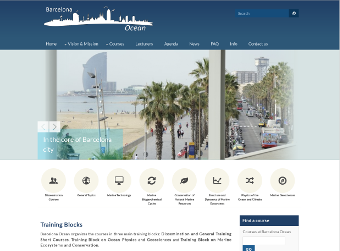 2015 - : presently giving lectures within the Barcelona Ocean initiative
- 2006 - 2009: professor within the Master Program in Oceanography given by Universidad de las Palmas de Gran Canaria. I share the course lectures on Methods in Physical Oceanography with Dr. Jaume Piera and Dr. Joaquim Ballabrera. These lectures are also within the Master in Marine Sciences: Oceanography and Management of the Marine Environment given jointly by the University of Barcelona (UB) and the Universidad Politècnica de Catalunya (UPC).
- 1997-1999: Associated Professor of the Statistical Physics Group (Physics Department) at the Universitat Autónoma de Barcelona (UAB). He was responsible of teaching within the Environmental Sciences Program (CCAA) the following courses:
- Oceanography
- General Physics for Environmental Sciences
- Meteorology
- 1990-1997: Assistant Professor of the Statistical Physics Group (Physics Department) at the Universitat Autònoma de Barcelona (UAB). I was responsible of giving lectures about General Physics, Fluid Mechanics, Mathemathical Methods.
- PhD Students:
- Vicenç Parisi, now at Departament d'Enginyeria Electrònica (UPC)
- Jordi Isern-Fontanet, now staff member at the Departament d'Oceanografia Física (DOFT-ICM)
- Jordi Solé
- Ramon Reig, now at Grupo de Codiseño Hardware Software (UVIC)
- Articles
- Personal Image Galery (coming soon)
- Detailed Curriculum